Space Science
Lava Flows Down Mayon
Mar 18, 2026, 3:19 PM
出典: NASA News
The OLI (Operational Land Imager) on Landsat 8 acquired this rare, relatively clear image of  Mayon, the most active volcano in the Philippines, on Feb. 26, 2026. The natural-color scene is overlaid with infrared observations to highlight the lava’s heat signature. On that day, the Philippine Institute of Volcanology and Seismology (PHIVOLCS) reported volcanic earthquakes, rockfalls, and hot clouds of ash […]
Details
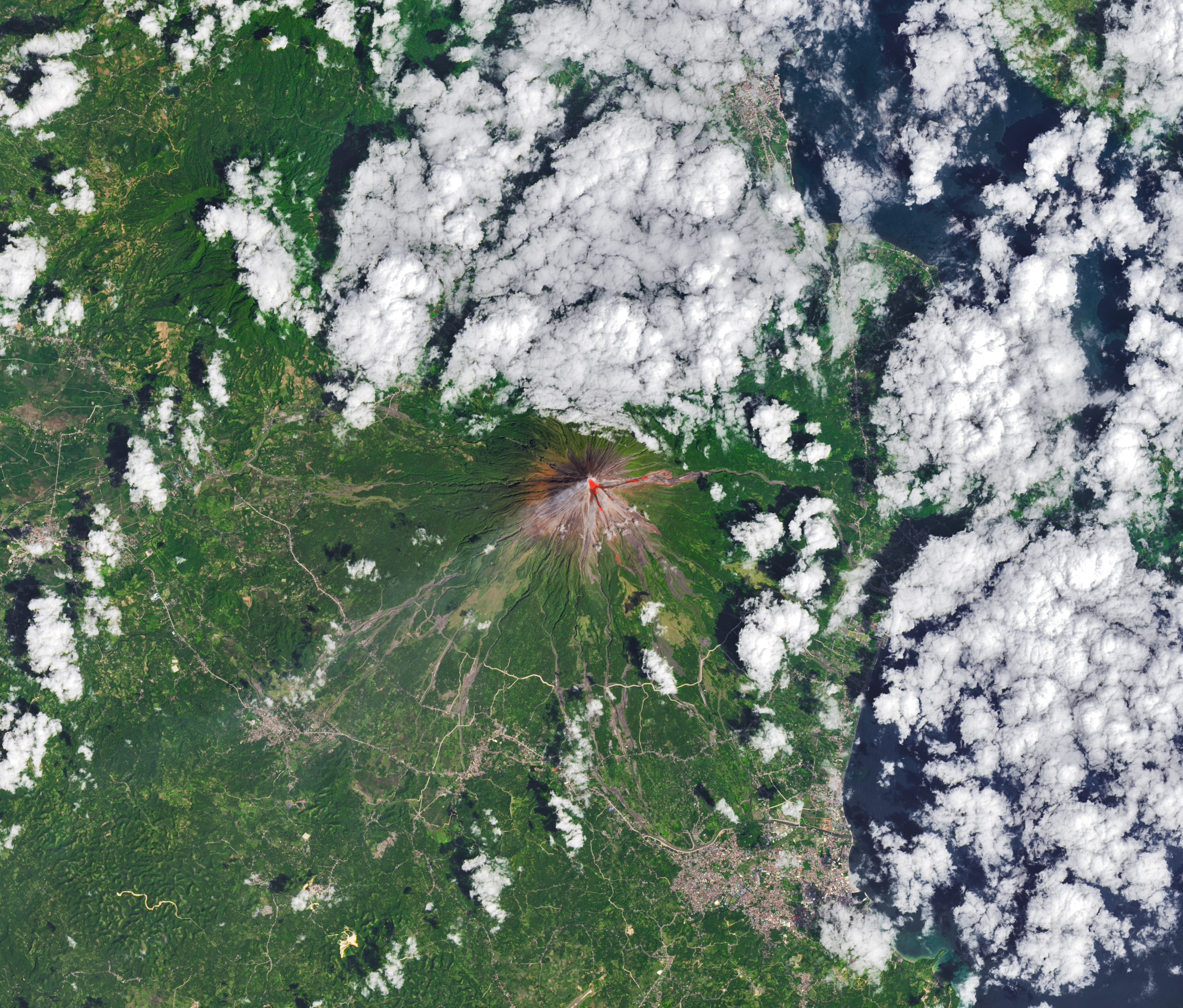
At any given moment, about 20 volcanoes on Earth are actively erupting. Often among them is Mayon—the most active volcano in the Philippines.
Michala Garrison, using Landsat data from the U.S. Geological Survey
The OLI (Operational Land Imager) on Landsat 8 acquired this rare, relatively clear image of Mayon, the most active volcano in the Philippines, on Feb. 26, 2026. The natural-color scene is overlaid with infrared observations to highlight the lava’s heat signature. On that day, the Philippine Institute of Volcanology and Seismology (PHIVOLCS) reported volcanic earthquakes, rockfalls, and hot clouds of ash and debris called pyroclastic flows. Along with PHIVOLCS, multiple NASA satellites also monitored the volcano’s sulfur dioxide emissions, showing sizable plumes of the gas drifting southwest on February 4 and March 6.
Text credit: Adam Voiland
Image credit: Michala Garrison, using Landsat data from the U.S. Geological Survey
Related Knowledge
mentions
Volcanology
Volcanology is the study of volcanoes, lava, magma, and related geological, geophysical, and geochemical phenomena. It encompasses the processes that lead to volcanic eruptions and the impact of these eruptions on the environment and human activities.
mentions
Remote Sensing
Remote sensing is the acquisition of information about an object or phenomenon without making physical contact. This technology is commonly used in Earth observation to monitor environmental changes, track natural disasters, and study climate patterns using satellite imagery and aerial photography.